
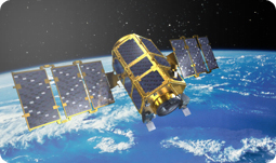
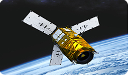
September 27, 2003
Korean peninsula observation science experiments
Plesetsk, Russia
ROCKOT #13
Korea Aerospace Research Institute
3.0(w) x 1.8(length) M
800 Kg
98.1˚
S-band
3 years
New satellite communications services, and practical exam HDTV and 3DTV service verification
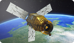
May 17, 2012
Provide geographical information on Earth
Tanegashima, Japan
H- ll A
Korea Advanced Institute of science and technology
2.0(diameter), 3.4(high) M
1,000 Kg
98.1˚
Ku-band
4 years
Engance national security, cope with natural disasters, better manage resources and monitor the environment.
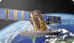
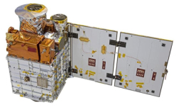
August 22, 2013
Earth boservation, Rader
Yasny, Russia
Dnepr
Korea Aerospace Research Institute(KARI)
4,000 x 3,700 x 9,100 mm
1,315 Kg
97.6˚
X-band
5 years
Day and night all-weather earth observation satellite : Equipped with 1 meter resolution imagin radar(SAR)
September 27, 2003
Korean peninsula observation science experiments
Plesetsk, Russia
ROCKOT #13
Korea Aerospace Research Institute
3.0(w) x 1.8(length) M
800 Kg
v
S-band
3 years
New satellite communicati -ons services, and practical exam HDTVand 3DTV service verification
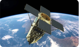
May 26, 2015
Precision earth observation
Yasny, Russia
Dnepr
Korea Aerospace Research Institue
(KARI)
2,000 X 3,800 X 6,300mm
1,100 Kg
97.51˚
X-band
4 years
High-resolution earth obser -vation images available
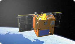
December 04, 2018
Scientific Observation
Vandenberg AFB, California
Falcon-9
KAIST
0.6m(W) X 1.6m(L) X 1m(H)
100 Kg
97.77˚
X-BAND
2 years
Purpose of development of small satellite standardization platform
March 22, 2021
Land observation
Kazakhstan Baikonur
Soyuz – 2 (Russia)
Korea Aerospace Research Institute
140 X 155 X 289 mm
500 kg
-
X-band
4 years
The CAS500-1 satellite is the low-orbit practical satellite for precision ground observation developed by KARI with support from MSIT and MOLIT.The missions of CAS500-1 satellite are providing high resolution ground images to meet public sector demands for land/resource observation and disaster moni -toring and providing stereo images for national geometric information services.
Copyright(C) 2012. Satellite Radio Monitoring Center(SRMC). All Right Reserved.
If you have any questions or comment about this website, contact us at e-mail srmc@korea.kr


